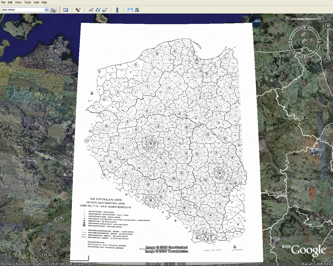
Proposed by Walter Christaller in 1933, the 'Central Place Theory' is among the first topics covered by any course in Geography, Regional Science, Urban Studies etc. His main point was to derive the golden rules that would explain the number, location and size (hierarchy) of cities/villages.
To illustrate his proposition, Christaller came up with this classic map showing the distribution of cities and villages in Eastern Europe, where circle indicates population size.
[click on the image to enlarge it]
Sometimes I wonder what those geniuses from the Old Times (like Christaller, Dalí, Paganini) would create if they had the technology we take for granted today. Well, if only Christaller had Google Earth at his time, I'm sure he would have done a much better job. And I think he would have liked to work with Sandra Lach Arlinghaus!
[Image Credit: Sandra Lach Arlinghaus]